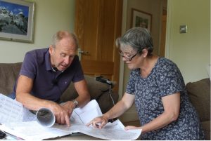
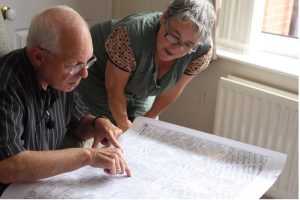
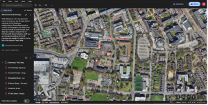
This is the second of our University of Manchester Social Responsibility projects exploring the largely ignored working class history of Greenheys, an area behind the university now housing the Science Park. Building upon previous work, this project again brought together past residents and volunteer SALC, SEED and SOSS students and staff for a Community History Day in the fantastic Old Abbey Taphouse. Over coffee and cake students helped past residents locate their old homes on large scale printed 1960s maps. Students then used digital mapping technology (Digimap) to locate grid references for each home and planned a walking route. Using GPS our students led residents out into the Science Park to find the present locations of their past homes. This process was used to elicit resident memories of life in Greenheys up until the 1970s.
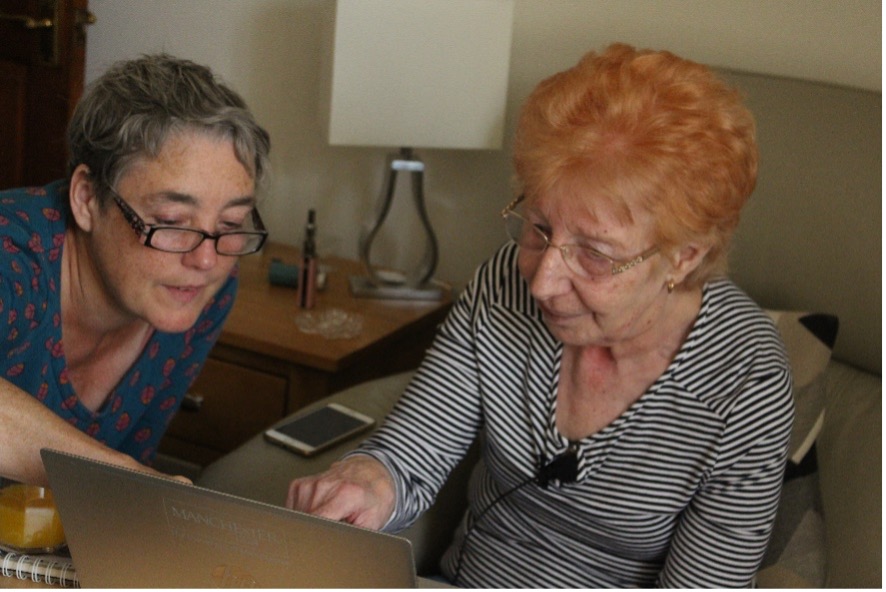
However, this time we took it a stage further. Having identified past residents, staff and students then visited them in their current homes to record their Greenheys stories. We have now started the process of curating these stories within a digital map of the area.
As such the project is an ongoing social and technical experiment and if you want to see where we are up to check out this Google Earth project. Once open, click onto the ‘Slideshow’ button and this will lead you through the interviews completed to date.
Thanks to the University of Manchester Social Responsibility fund for helping to make this happen.
Internal partners: Dr John Piprani (Archaeology), Dr Mary Begley (Linguistics), Jack Doyle (Archaeology), Alex McGaughrin Cross (Elearning).
External partners: Rachele Evaroa (landlady, Old Abbey Taphouse), Liz Faye (independent researcher).
Help on the day: Dr Tom Bishop (Geography), Laura Thompson (Archaeology), Jordan Perris (Archaeology), Harry Thornton (Sociology), Christina Straub (volunteer), Rafe Conn (independent filmmaker).