Geocomputing, imaging and visualisation
Our geocomputing, imaging and visualisation work focuses on using visualisation and interpretation software tool for field based geology and geophysics, as well as for geoscientists working with 3D digital outcrop models (DOM).
Contact information
For enquiries in this area, contact David Hodgetts. To find more details of researchers across the Basins group, see the People page.
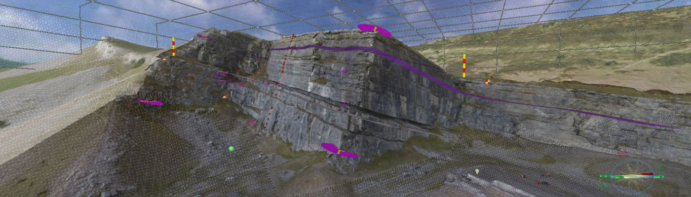
Using Virtual Reality Geological Studio (VRGS), multiple attributes can be calculated based on surface geometry and used to assist interpretation.
Visit the VRGS website to find out more about how the software assists our work.
Visit the VRGS website
Find out more about how our researchers work with Virtual Reality Geological Studio on the dedicated website.
Contact Us
+44 (0) 161 306 6000